Rupin Pass lies in the Garhwal Himalayas (Uttarakhand) and kinner kailash (Sangla, Himachal). Rupin Pass Trek is one of those treks that is on “to-do list” of many trekkers. Being a moderate trek, it is a wonderful trek for trekkers who wish to explore what a moderate grade trek feels like. One major attraction that attracts most trekkers is the fact that it is a “2 states” trek, meaning that it starts in Uttarakhand and ends in Himachal Pradesh. This trek gives us an opportunity to understand the cultural and language differences and similarities between people living in villages on both sides (Dhaula, Sewa, Jiskun & Sangla).
Other than the cultural side, this treks beauty is best seen in the second season (Sept - Oct). From beautiful villages, to warm home-stays, dense forest patches, a few river crossings, amazing views of the multiple waterfalls at Dhaneras-thatch (lower waterfall), to getting to the Rupin Pass via a steep gully, the experience is simply amazing.
Day 1) Dehradun to Dhaula (Drive – 7 hours/180kms) (5,200 feet)
Dehradun to Dhaula is a drive of 8 to 9 hours. We start as early as possible from Dehradun. We stop for breakfast at Kempti falls and continue to move forward. We halt for lunch at Purola. We halt next at the check-post of Naitwar for the permissions & permits. Post that, we will take an hour and get to Dhaula.
We have a briefing session in the evening along with tea and snacks. As this is not a circuit trek [starting in Dhaula (Uttarakhand) and ending in Sangla (Himachal)], we do not have cloak room facilities.
Day 2) Dhaula to Sewa (5hours/10kms) (5,200 feet to 6,250 feet)
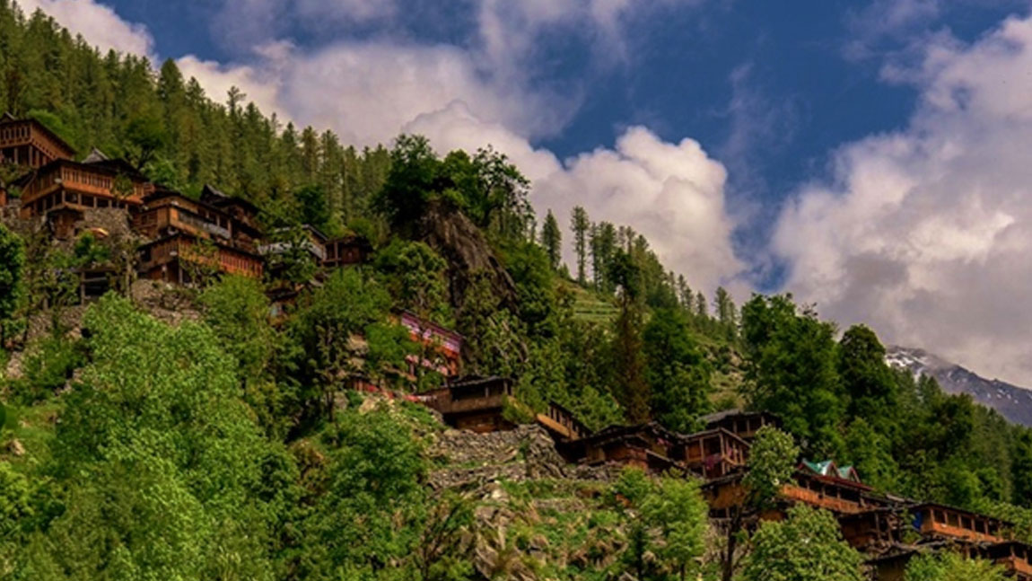
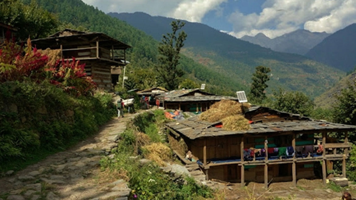
After an early breakfast, we start our trek to Sewa. Sewa is a beautiful village with a lot of homestay options. The trail today starts with a moderate level ascend followed by a straight trek to enter the village of Sewa. Today’s will be a 10kms trek that would take about 5 hours to cover. We reach post lunch and rest for the rest of the day.
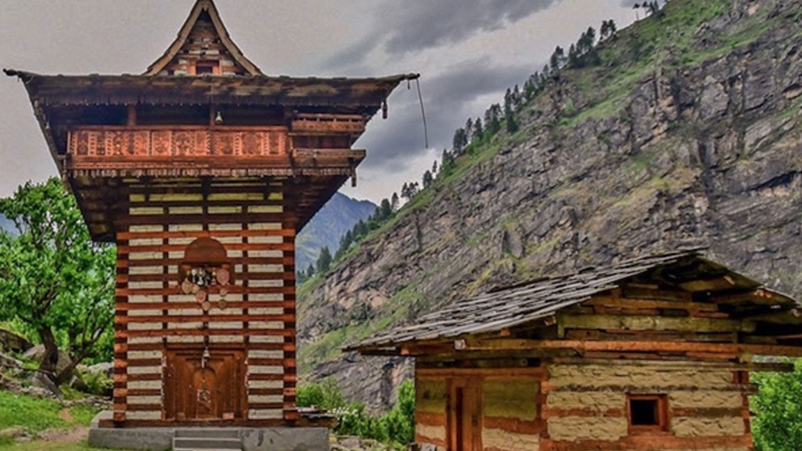
There is a double story temple in Sewa and is said to be existing since the time of Pandavas. The architecture of this temple proves the fact of its existence being extremely old. Post tea, we head towards this temple for a short walk in the evening.
Day 3) Sewa to Jiskun (4hours/ 8kms) (6,250 feet to 7,800 feet)
The trek today starts with an easy trek for a couple of hours. This trek leads to a steep ascend which takes a bit of an effort to negotiate. We cross over the Rupin river through the metal bridge. On one side we have the state of Uttrakhand and the other is Himachal. Airtel, BSNL networks are available there (depending upon the weather conditions).
Day 4) Jiskun to Udakanal (5hours/ 8kms) (7,800 feet to 10,400 feet)
We start today with a steep descend till the water body. About an hour later we have a steep ascend to reach Jakha. Jakha is the last village on our trek before the Rupin pass. Jakha is 3kms from Jiskun. The trail to Jakha is of stones and through forests. Post Jakha, we have a steep ascend straight to the Fir forest. We cross this patch of forest and get straight to a steep descend over stones and boulders. This patch is a beautiful trail with mesmerizing views all around. This is a beautiful spot for Lunch and for re-filing water.
It would take us nearly 5 to 6 hours to complete this stretch. Post lunch, we have a couple of hours ascend to get to the clearing amidst tall pine trees – Udakanal.
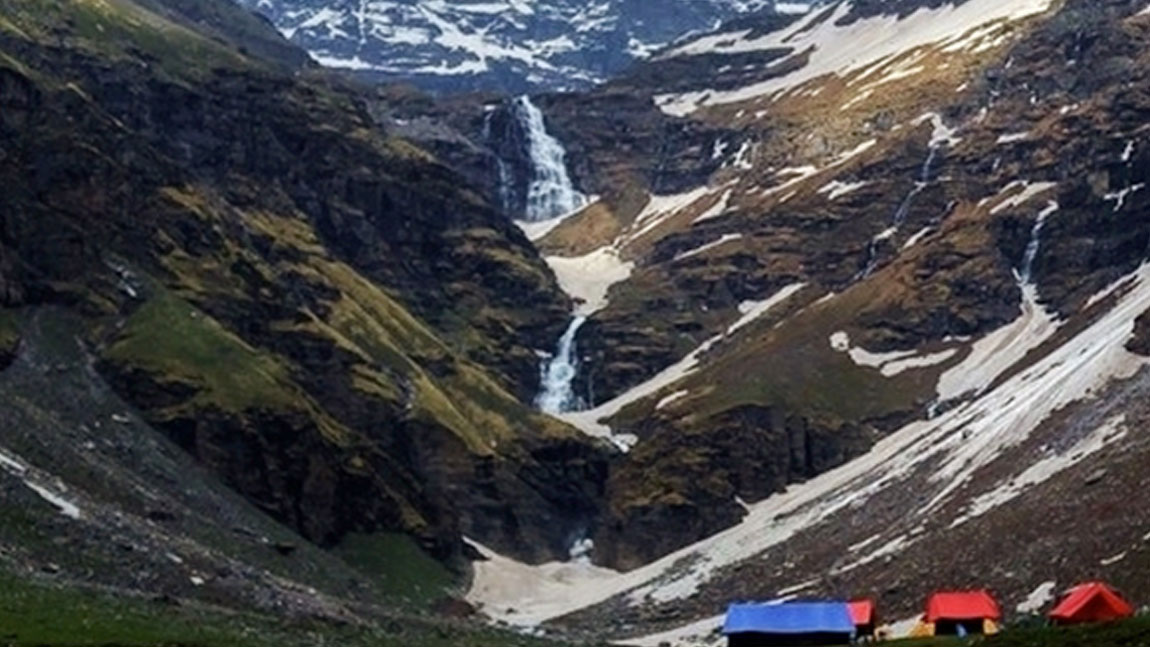
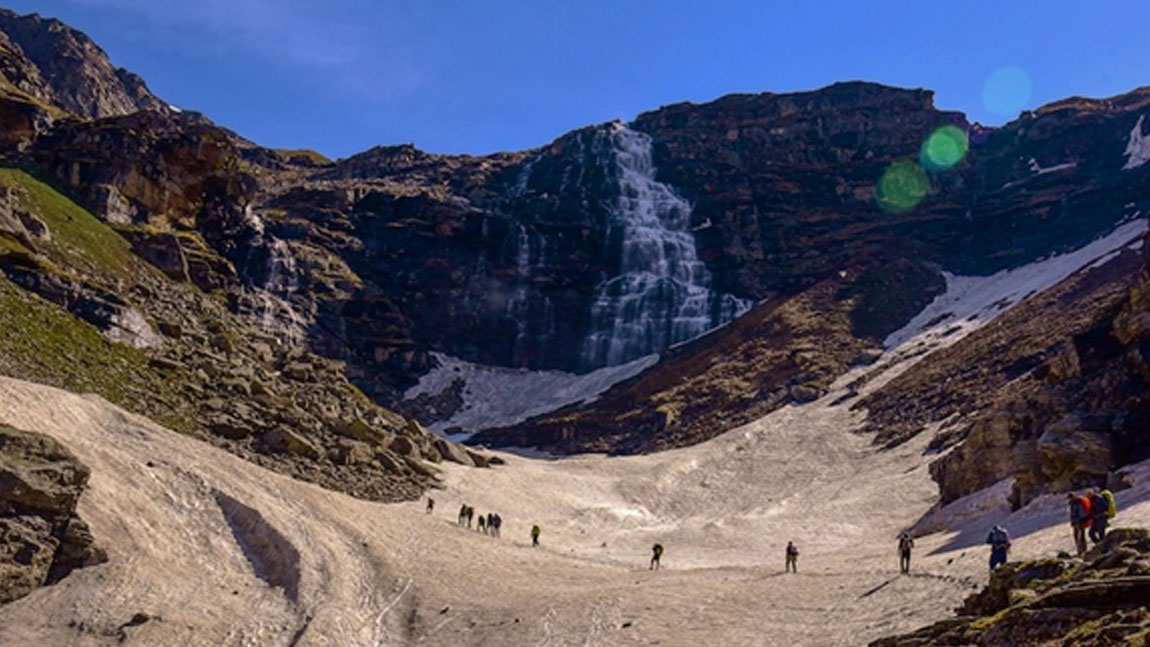
Day 5) Udakanal to Dhanderas-thatch (lower waterfall) (4 hours/5kms) (10,400 feet to 11,800 feet)
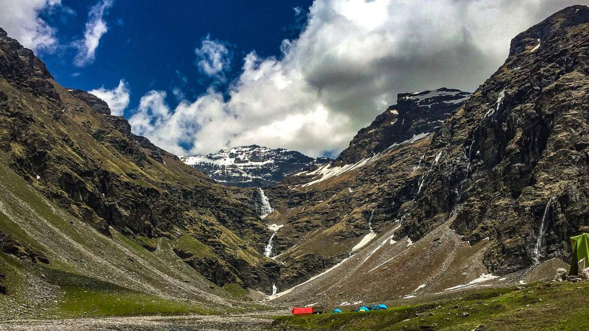
Today’s trek is short compared to all the other days – a total of 5kms trek. The route starts with taking a steep ascend to the right side of Udakanal. The Rupin river now flows on our left side. The views today are just amazing. We can see the top of the upper waterfall, from under which we see the huge waterfall. The U-shaped valley gives us some of the most amazing views in the second half of the year. September & October months are colder in terms of temperatures, but they also provide amazing views of the waterfalls. Not just the lowers and upper waterfall, we can see small waterfalls all around the mountains which is a treat to the eyes.
As we gain altitude, we trek at a slow to moderate pace. Post evening tea, we need to go for a short acclimatization walk, which prepares us for higher and better acclimatization.
Day 6) Dhanderas-thatch to upper waterfall (3 hours/ 3kms) (11,800 feet to 13,300 feet)
The trek from Dhanderas thatch to upper waterfall is the shortest in terms of distance – 3kms. Having said that, we camp at the highest camp this night, at 13,300 feet. We start the trek early today to get to the upper waterfall. Depending upon the snow, ice or verglass conditions, we trek at a decent pace.
The views from the upper waterfall are amazing. We get to the see the route/ trail that we had taken to get there. At this altitude, we need to ensure to trek higher and return (acclimatization walk). This walk is extremely important for us as we attempt the Pass the next day.
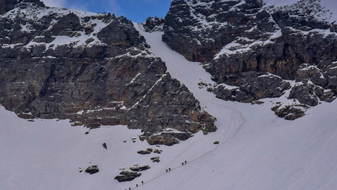
Day 7) Upper waterfall (13,300 feet) to Rupin pass (15,250 feet) to Rontigad (13,200 feet) (13kms/ 11hours)
We start early in order to cross the pass at the right time. The route starts with an hour of steep ascend. This trail is difficult, and we reach up to the open clearing – Rata pheri. This used to be a camping space earlier however due to its altitude, trekkers have stopped camping here. Also, the water sources here aren’t reliable in terms of availability and cleanliness. From Rata pheri we trek for 45 mins on flat terrain and we start our gradual ascend to the pass. This is a gully which is not only steep, it’s also quite challenging. This gully climb takes nearly an hour to get to. The distance of the gully is 200 metres, yet the challenge is of the lose stones/ rocks and scree. The pass is a saddle on a ridge line cutting through and across the Dhauladhar range. On reaching the top, we get to see the views of the other side – Sangla. You get to see the Kinnaur – Kailash range from the pass on this side. After spending some time on the pass, we start our descent to Sangla Kandi/ Ronti gad. It is a steep route downwards. In the first half of the year, the snow conditions provide perfect conditions to slide down. In the second half of the year, we need to trek down all the way as there might not be adequate or any snow at all to slide down.
It takes about 3 hours for us to get down to the campsite of Ronti Gad.
This is going to be the coldest night of the trek. So, we make sure to be warm and rest for the night post a good meal.
Day 8) Ronti gad to Sangla (12kms/ 6hours) (13,200 feet to 8,800 feet)
We start our descend to Sangla via Kandi-Sangla to get to the Baspa valley. We take the trail that leads us straight to Sangla. We avoid taking the lower routes that lead to the river. We get to see the Kinnaur Kailash range towering at 20,000 feet from kandi-Sangla. From here we continue our descend.
We get to the starting point of the village where locals practice agriculture and we cross over their fields. A lot of local houses also offer the local liquor here. We may be able to smell the fermentation while crossing over. We get to the temple where we can stop for rest. It is important that from this point the entire team treks down together till the end of the trek as there are multiple routes to descend from here.
After reaching Sangla, we end the trek. You can either choose to stay the night here and get to Shimla the next day, else head to shimla the same night. We recommend staying the night in the hotel and heading to Shimla only the next day.
Inclusions:
1) Meals - All the meals from Dhaula to Sangla.
2) Accommodation -
- Camping/forest guest houses/homestays while on trek on twin sharing basis.
- While camping, wanderers will provide: dry cleaned sleeping bags and mattresses with fresh individual fleece liner for hygiene.
- Toilets – clean and hygienic.
3) Trek Leader - An experienced mountaineer who is also a certified wilderness first aid responder.
4) Guide - There will be a well experienced local guide who is well versed with the local topography.
5) Camping & trekking permits and permissions from the local administrations/ authorities.
6) Other Equipment (if required) can be rented from Wanderers.
Exclusions:
1) Transport - To the base (Dhaula) and back.
2) Any meals/services not mentioned above
3) Any costs in accommodation & food arising out of unforeseen circumstances like landslides, road blocks, bad weather, etc.
4) Insurance
5) Alcohol, soft drinks, beverages, etc.
6) Personal expenses like tips, telephone calls, laundry, etc.
7) Any charges for video cameras, still cameras, etc.